function initMap() {
var myLatLng = { lat: 55.668130, lng: 37.517922 };
var myLatLngW = { lat: 55.654391, lng: 37.587731 };
var myLatLngS = { lat: 55.836947, lng: 37.343976 };
// Create a map object and specify the DOM element for display.
// Create a map object and specify the DOM element for display.
var map = new google.maps.Map(document.getElementById('map'), {
center: myLatLng,
scrollwheel: false,
styles: styleArrayContacts,
zoom: 10
});
var map = new google.maps.Map(document.getElementById('map'), {
center: myLatLngW,
scrollwheel: false,
styles: styleArrayContacts,
zoom: 10
})
var map = new google.maps.Map(document.getElementById('map'), {
center: myLatLngS,
scrollwheel: false,
styles: styleArrayContacts,
zoom: 10
})
var image = new google.maps.MarkerImage('img/marker.png',
new google.maps.Size(20, 32),
new google.maps.Point(0, 0),
new google.maps.Point(0, 32));
var contentString1 =
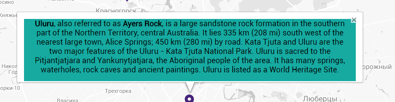
'<p style="color: #000;"><b>Uluru</b>, also referred to as <b>Ayers Rock</b>, is a large ' +
'sandstone rock formation in the southern part of the ' +
'Northern Territory, central Australia. It lies 335 km (208 mi) ' +
'south west of the nearest large town, Alice Springs; 450 km ' +
'(280 mi) by road. Kata Tjuta and Uluru are the two major ' +
'features of the Uluru - Kata Tjuta National Park. Uluru is ' +
'sacred to the Pitjantjatjara and Yankunytjatjara, the ' +
'Aboriginal people of the area. It has many springs, waterholes, ' +
'rock caves and ancient paintings. Uluru is listed as a World ' +
'Heritage Site.</p>';
var infowindow1 = new google.maps.InfoWindow({
content: contentString1
});
var contentString2 =
'<p style="color: #000;"><b>Uluru</b>, also referred to as <b>Ayers Rock</b>, is a large ' +
'sandstone rock formation in the southern part of the ' +
'Northern Territory, central Australia. It lies 335 km (208 mi) ' +
'south west of the nearest large town, Alice Springs; 450 km ' +
'(280 mi) by road. Kata Tjuta and Uluru are the two major ' +
'features of the Uluru - Kata Tjuta National Park. Uluru is ' +
'sacred to the Pitjantjatjara and Yankunytjatjara, the ' +
'Aboriginal people of the area. It has many springs, waterholes, ' +
'rock caves and ancient paintings. Uluru is listed as a World ' +
'Heritage Site.</p>';
var infowindow2 = new google.maps.InfoWindow({
content: contentString2
});
var contentString3 =
'<p style="color: #000;"><b>Uluru</b>, also referred to as <b>Ayers Rock</b>, is a large ' +
'sandstone rock formation in the southern part of the ' +
'Northern Territory, central Australia. It lies 335 km (208 mi) ' +
'south west of the nearest large town, Alice Springs; 450 km ' +
'(280 mi) by road. Kata Tjuta and Uluru are the two major ' +
'features of the Uluru - Kata Tjuta National Park. Uluru is ' +
'sacred to the Pitjantjatjara and Yankunytjatjara, the ' +
'Aboriginal people of the area. It has many springs, waterholes, ' +
'rock caves and ancient paintings. Uluru is listed as a World ' +
'Heritage Site.</p>';
var infowindow3 = new google.maps.InfoWindow({
content: contentString3
});
var image = new google.maps.MarkerImage('img/marker.png',
new google.maps.Size(20, 32),
new google.maps.Point(0, 0),
new google.maps.Point(0, 32));
var marker1 = new google.maps.Marker({
map: map,
icon: image,
position: myLatLng,
});
var marker2 = new google.maps.Marker({
map: map,
icon: image,
position: myLatLngW,
});
var marker = new google.maps.Marker({
map: map,
icon: image,
position: myLatLngS,
});
marker1.addListener('click', function() {
infowindow1.open(map, marker1);
});
marker2.addListener('click', function() {
infowindow2.open(map, marker2);
});
marker3.addListener('click', function() {
infowindow3.open(map, marker3);
});
google.maps.event.addListener(infowindow, 'domready', function() {
var iwOuter = $('.gm-style-iw');
iwOuter.parent().parent().css({ top: '10px' });
iwOuter.prev().hide();
iwOuter.next().hide();
});
}